We remain fully operational. Our teams are working around the clock to ensure your deliveries continue safely.

DOWNLOAD THE APP


Customer Services
Copyright © 2025 Desertcart Holdings Limited
DOWNLOAD THE APP

🧭 Navigate Puget Sound Like a Pro — Stay Ahead, Stay Dry!
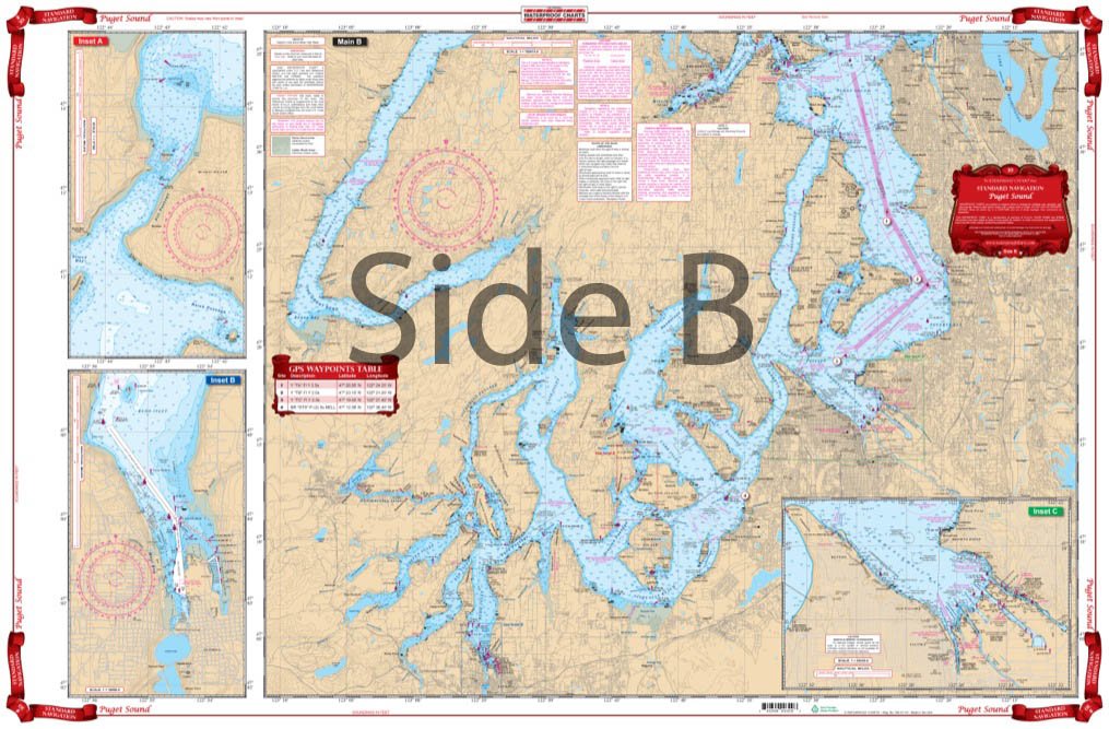
The Standard Navigation 30 Puget Sound chart offers comprehensive, double-sided coverage of key marine areas from Olympia to Port Townsend. Printed on durable, waterproof, and tear-resistant polypropylene, it integrates GPS waypoints and color-coded insets for enhanced usability. Compiled from six NOAA charts and local data, this chart is a must-have for precise, reliable navigation in Puget Sound.
| ASIN | B00C34UGLO |
| Best Sellers Rank | #1,362 in Marine GPS Accessories |
| Brand Name | Waterproof Charts |
| Customer Reviews | 4.7 4.7 out of 5 stars (6) |
| Date First Available | March 29, 2013 |
| Item Weight | 16 ounces |
| Manufacturer | Waterproof Charts |
| Material | Polypropylene |
| Part Number | 30 |
S**B
Five Stars
Great maps with awesome details
Trustpilot
3 days ago
1 month ago