Maptech Upper Chesapeake Bay Waterproof Chart | Desertcart Ireland
Maptech - Upper Chesapeake Bay Waterproof Chart
3.7/5
Product ID: 28525767
Secure Transaction
Frequently Bought Together
Description
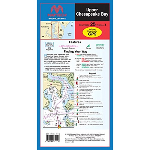
Completely updated. Newest edition. 4th Edition
Detailed coverage of C&D Canal to the Potomac River
Featuring waypoints for major buoys, courses and distances, and ramp locations and information. Great planning chart
24" x 36"
scale 1:114,000
Detailed coverage of C&D Canal to the Potomac River. Featuring waypoints for major buoys, courses and distances, and ramp locations and information. Great planning chart. 24 x 36, scale 1:114,000
Common Questions
Trustpilot
TrustScore 4.5 | 7,300+ reviews
Neha S.
Excellent communication throughout the order process. Product is perfect.
2 weeks ago
Rajesh P.
Customer service was outstanding when I had questions about the product.